A loop of about 1,320 km
Route 1, the Ring Road, runs right round Iceland in one closed loop of about 1,320 km. It joins Reykjavík to the south coast, the glacier lagoons, the East Fjords, the lava country around Mývatn and the north, then comes back down the west to the capital. Almost all of it is paved, usually one lane each way with no hard shoulder, and for long stretches you share it with little except sheep and the weather.
The driving time alone is shorter than people expect. The trouble is that you will want to stop every half hour. Seven days is the least that works without turning the loop into a chore; ten gives you room for side roads, a bad-weather day and the walks that make the stops worth it. Most drivers start at Keflavík airport or in Reykjavík and go anticlockwise, south coast first, because the big waterfalls come early and the long empty run through the north can then be taken at whatever pace is left. Clockwise works just as well and saves the busiest stretch for the end.
Waterfalls and black sand along the south coast
Within two hours of the capital the road runs along the foot of the mountains with the sea a few kilometres off to your right. Seljalandsfoss drops off an old sea cliff close to the road, and a path takes you behind the curtain of water: expect spray and keep your waterproof on. Skógafoss, a little further east, is a broad white wall of water with steps up the side to the top.
Vík is the village at the end of this stretch, set under green headlands with sea stacks standing offshore. The black beaches here are beautiful and dangerous. Some waves run much further up the sand than the ones before them, without warning, and people have been pulled in. Keep well back from the water's edge and never turn your back on the sea.
East of Vík the land flattens into wide plains of black sand and gravel laid down by glacial floods. In strong wind, sand blows across the road hard enough to strip paint and pit glass. If a storm warning is out, sit it out in the nearest village rather than pushing on.
Ice on the water at Jökulsárlón
Past Skaftafell, in Vatnajökull National Park, glacier tongues come down almost to the road. Then Jökulsárlón opens up on your left: a lagoon full of icebergs that have broken off the glacier and drift slowly towards the sea. Route 1 crosses the short river at the lagoon's mouth on a bridge, and on the far side the ice that escapes lies stranded on a black beach. Park only in the marked areas; the road is narrow here and visitors walk across it.
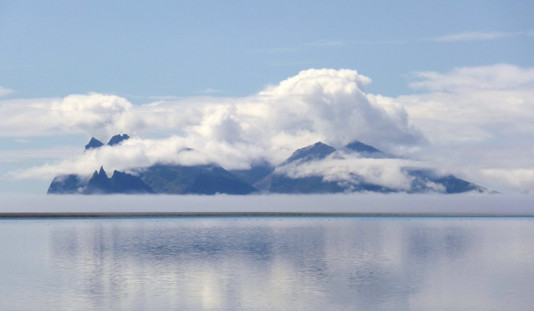
From Höfn the road turns north. The jagged peaks of Vestrahorn stand on the coast east of town, often with cloud wrapped round their shoulders. This is also where one-lane bridges become common. The car nearer the bridge goes first, so slow down well before you reach one and look across to see who is coming.
Detour · stop 05The Atlantic Road, eight kilometres across the seaThe East Fjords at a slower pace
Through the East Fjords the roads wind in and out of long inlets, each with a small fishing village near its head. It is the quietest part of the loop, and it rewards a slower day. Distances look short on the map and take longer than you think, because the road follows every curve of the shore. Fuel stops are spread out here too: fill up when you can rather than when you must, as the notes on fuel and distance explain.
Egilsstaðir, beside a long lake inland, is the main town of the east and the last real stop before the climb onto the high plateau. Between there and Mývatn the road crosses empty upland, high enough for snow to lie late into spring and arrive early in autumn.
Lava, steam and the long road home
Mývatn is a shallow lake in a volcanic basin, ringed with lava formations, small craters and steaming ground. East of the lake the air smells of sulphur and mud pots bubble beside the road. Stay on marked paths: the crust near hot springs can be thin, and the water under it is scalding.
West of Mývatn, Goðafoss sits close to the road, and Akureyri, the north's main town, has everything you need for a rest day. From there the road crosses long valleys and passes, past horse farms and wide fjords, down to Borgarnes and back to the capital.
Gravel, F-roads and the rules that matter
Route 1 itself is paved, but many roads off it are gravel: the turns to waterfalls, farms and smaller fjords. Drop your speed when the asphalt ends, keep to the middle until you meet traffic, and pull well over when you do. Stones fly up from passing tyres, and many hire contracts treat windscreen and paint damage on gravel differently. Read yours before you leave, and see gravel roads in a hire car for what to check.
The F-roads, the mountain tracks across the interior, are another matter. They open only in summer, usually from late June or July, they need a four-wheel-drive vehicle, and many have rivers with no bridge. A normal car does not belong on them. Driving off road anywhere, on moss, sand or lava, is illegal in Iceland, and the tracks you leave can scar the ground for decades. Stay on marked roads, every time.
Wind is what catches most drivers out. Open your door with both hands on it, because a gust can bend it back on its hinges. Sheep roam freely in summer, and lambs often dart across to their mothers at the last moment. Never stop on the road itself for a photograph, however good the view; use the pull-outs.
High summer or the shoulder months
June to August brings long light, every road open and the most traffic. May and September are quieter and often the better balance, though some side roads and services may not yet be open or may already have closed. From October to April you face short days, snow, ice and storms that can shut stretches of Route 1 for a day or more. The month-by-month notes compare the seasons on every road on this page. Whenever you go, check the national road administration's road conditions and the weather warnings each morning before you set off.
The photographs on this stop are credited, with their licences, on who took the road photos.