The Icefields Parkway, from Lake Louise to Jasper
About 230 km of glaciers, turquoise lakes and roadside wildlife between two Rocky Mountain towns, with almost no phone signal and very few places to buy fuel.
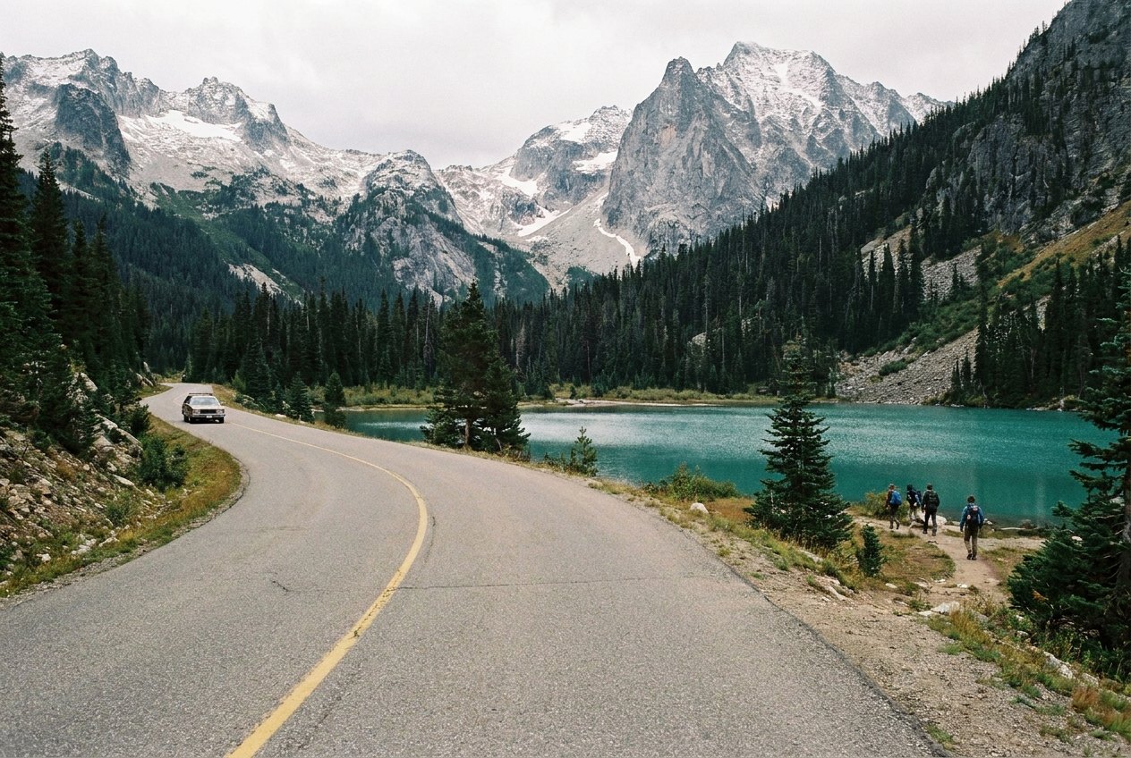
The Icefields Parkway, Highway 93 North, runs about 230 km between Lake Louise and Jasper through Banff and Jasper national parks in the Canadian Rockies. You could drive it in about four hours without stopping, but almost nobody does. The road follows a chain of valleys below a wall of peaks and glaciers, and every few kilometres there is a lake, a waterfall or a viewpoint that makes you pull over.
It is a well-built, two-lane paved road with wide shoulders and a modest speed limit. The challenge is not the driving itself but the remoteness: there is little or no phone signal for most of the way, only one place with fuel and services in the middle, and weather that can turn quickly at any time of year.
The pass and the rules of the parks
The parkway runs entirely within national parks, and you need a Parks Canada pass to stop anywhere along it, whether for a viewpoint, a walk or a picnic. Passes are sold by the day or the year and can be bought at park gates and visitor centres or in advance. The price of a pass changes, so check it before you go.
The park rules are simple and enforced. Do not feed or approach wildlife. Camp only in designated campgrounds. Leave rocks, flowers and antlers where they lie. Drones are not allowed without a permit. And keep your food and rubbish inside the car or in the bear-proof bins at the stops.
Lake Louise to the Columbia Icefield
From the junction near Lake Louise, the road heads north up the Bow Valley. The first big stop is Bow Lake, a broad sheet of blue-green water below the Crowfoot and Bow glaciers. It is a good place for a first walk along the shore.
Just beyond is Bow Summit, the highest point on the parkway at a little over 2,000 m, and the short climb to the Peyto Lake viewpoint. From the platform you look down on a lake of startling turquoise, coloured by rock flour carried by meltwater from the glaciers above. It is one of the most photographed views in the Rockies, so arrive early or late in the day to share it with fewer people.
North of the summit the road drops along the Mistaya River, past Waterfowl Lakes and the short trail to Mistaya Canyon, where the river has carved a narrow, twisting slot in the limestone. At Saskatchewan River Crossing you reach the only services on the parkway. They keep seasonal hours and fuel there is expensive, so fill up in Lake Louise or Jasper and treat this as a backup only.
From there the road climbs past the Weeping Wall, where streams spill down a cliff face beside the road, and up a series of long bends to Sunwapta Pass, the boundary between Banff and Jasper national parks. Pull into the Big Bend viewpoint on the way up to look back down the valley.
Driving the whole parkway in a day means you spend most of it in the car; staying a night along the way lets you catch the morning light at the lakes. If you are looking for another mountain road with glaciers and long views, the Milford Road in New Zealand is shorter but just as steep-sided.
Detour · stop 09The Milford Road, Te Anau to the edge of the seaThe Columbia Icefield and the Athabasca Glacier
Just past Sunwapta Pass the valley opens up and the Columbia Icefield comes into view. The icefield itself is a vast sheet of ice spread across the high plateau, mostly hidden from the road, but its tongues reach down toward the valley. The most accessible is the Athabasca Glacier, which ends a short walk from a parking area across the road from the visitor centre.
The walk to the toe of the glacier passes signposts marking where the ice stood in past years, and the distance between them shows how fast it has retreated. Stay behind the barriers: the glacier surface hides deep crevasses, and people have died after walking onto the ice without a guide and the right equipment.
The road follows a chain of valleys below a wall of peaks and glaciers, and every few kilometres there is a lake, a waterfall or a viewpoint that makes you pull over.
North of the icefield, the road follows the Sunwapta River down toward Jasper. Sunwapta Falls is a short detour, and Athabasca Falls, about 30 km before Jasper, is a powerful drop through a narrow gorge, with paths and bridges over the spray. From there the valley widens and the road runs into the town of Jasper.
Wildlife and how to behave around it
You will very likely see animals along the parkway: elk, bighorn sheep, mountain goats, deer and, if you are lucky, black or grizzly bears. When one appears near the road, cars tend to stop in a cluster, often in the lane, causing what locals call a wildlife jam.
Never stop in the road. If you want to look, slow down, signal, and pull fully onto the shoulder or into a pull-out where it is safe. Stay in your car, keep the windows mostly closed near bears, and move on after a minute or two. Getting out to approach an animal for a photograph is dangerous and against park rules.
Animals also cross the road without warning, especially around dawn and dusk. Keep to the speed limit, watch the verges, and avoid driving the parkway in the dark if you can.
Seasons, signal and winter tyres
The parkway is open all year, but conditions vary a lot by season.
- Summer (June to August) brings long days, full services and the busiest viewpoints. Wildfire smoke can haze the views in some summers, and fires can close the road.
- September is quieter, with crisp air and early snow on the peaks. Services begin to close toward the end of the month.
- Winter (roughly November to April) brings snow, ice, avalanche risk and very short days. Winter tyres or chains are required on the parkway in this period, services are closed, and the road can be shut for avalanche control or storms. Check the rules and the road report before you go.
- Spring is changeable, with snow lingering into May and lakes still frozen until late spring.
Whatever the season, there is little or no phone signal between the two ends. Download maps before you leave, tell someone your plan, and carry water, food, warm clothes and a blanket. In winter, add a shovel and a full tank: a closure can hold you up for hours.
If you are hiring a car, check that it has the right tyres for the season and whether the contract allows mountain driving in winter. Our notes on the shoulder months on every road cover the in-between seasons in more detail, and our guide to planning fuel over long distances applies here too. For another coastal drive in North America, see Highway 1 through Big Sur.
The photographs on this stop are credited, with their licences, on who took the road photos.