Highway 1 through Big Sur
About 145 km (90 miles) of road cut into the cliffs between Carmel and San Simeon, with slow bends, rare fuel and a habit of closing after storms.
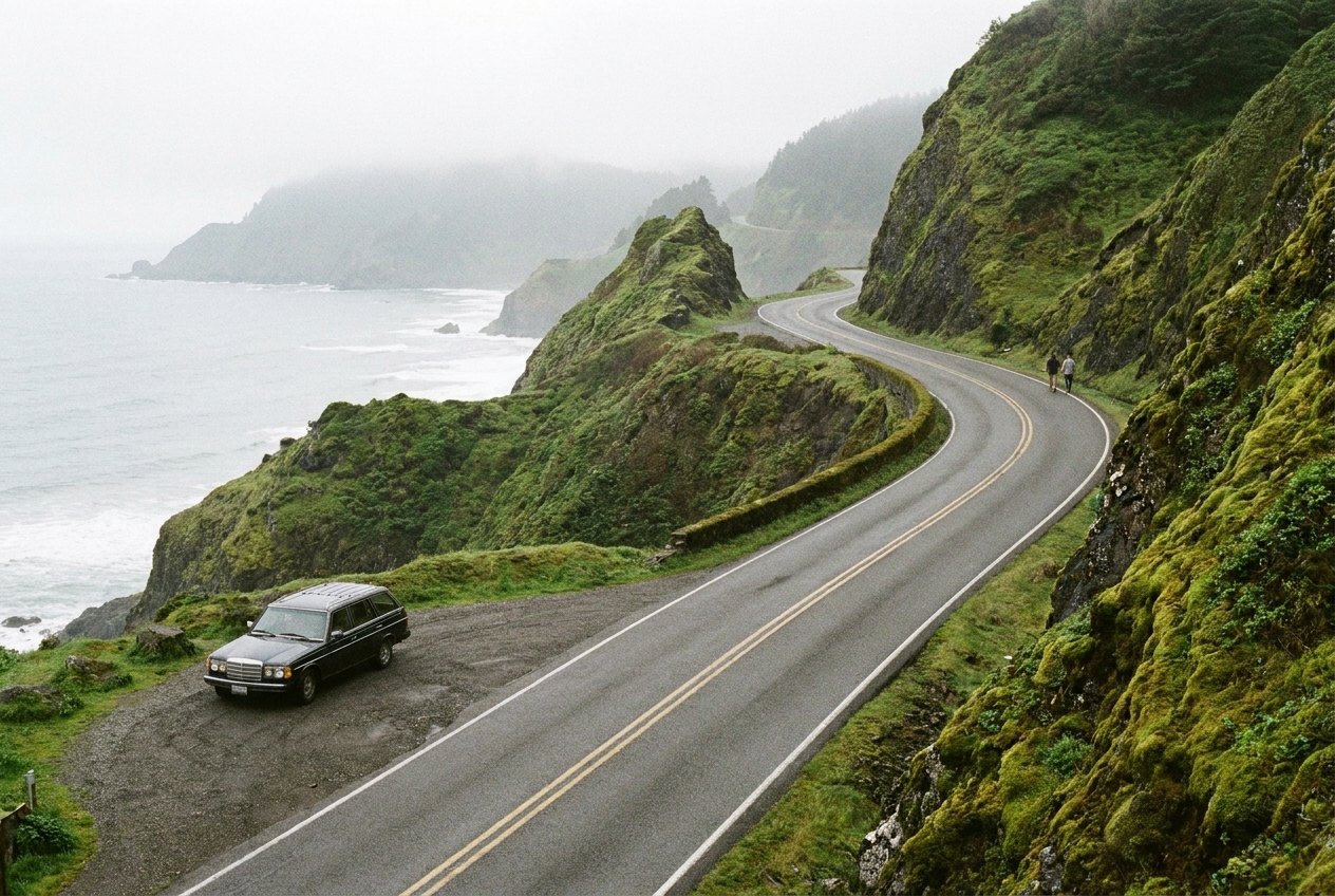
California State Route 1 runs along the edge of the continent for much of the state, but the stretch through Big Sur is the one people cross the world to drive. Between Carmel in the north and San Simeon in the south, about 145 km (90 miles) of road is cut into steep slopes where the Santa Lucia Mountains drop straight into the Pacific. There are no towns of any size, few side roads and long sections with nothing between you and the sea but a low barrier and a long drop.
You could drive it in three hours. Give it a full day, or two with a night in the middle, and stop often.
Bridges, cliffs and the coast that made the road
The road through Big Sur was finished in the 1930s after years of work blasting a ledge into the cliffs. Its best-known piece is the Bixby Creek Bridge, a concrete arch completed in 1932 that spans a deep canyon about 20 km (13 miles) south of Carmel. There are pull-outs at both ends, but they fill quickly and the traffic is constant, so park fully off the road and watch your step at the edge.
Further south, Point Sur rises from the sea on a volcanic rock topped by a lighthouse, and Pfeiffer Big Sur State Park offers trails under redwoods along the Big Sur River. The stretch around the middle of the coast has a handful of places to eat and sleep, then the road climbs back onto the cliffs.
At Julia Pfeiffer Burns State Park, a short path leads to a view of McWay Falls, a waterfall that drops from the cliff onto a small beach in a cove of blue-green water. You cannot reach the beach itself, but the view from the trail is the reason most people stop.
Toward the southern end the slopes ease, the road comes down closer to the water, and near San Simeon you can pull over to watch elephant seals hauled out on the beaches at Piedras Blancas. Hearst Castle, a state historic park on the hill above San Simeon, marks the end of the drive for many people.
Slides, closures and how to check
Big Sur's cliffs are made of loose, fractured rock, and after heavy winter rain whole hillsides can slide onto the road or carry it away. Sections of Highway 1 have been closed for months at a time after major slides, and smaller closures and one-lane controls with temporary traffic lights are common in any year.
When the road is cut, you cannot drive straight through. Depending on where the closure is, you may be able to reach parts of the coast from one end only, or detour inland on US 101, which adds hours. Check the current status with Caltrans, the state transport department, before you set out, and check again on the morning you drive. Do not rely on a map that shows the road as open.
A closure can change your trip completely. If the highway is cut in the middle, you might drive in from Carmel and back again one day, then from the south another day. That can be a fine trip in its own right.
For a coast road in a different hemisphere, with cliffs, sea stacks and its own share of slides, the Great Ocean Road in Australia makes a good companion trip.
Detour · stop 03The Great Ocean Road, a memorial you can driveTurnouts, slow traffic and driving the bends
The road is two lanes, narrow, winding and often without much of a shoulder. Speeds are low and you will spend much of the day in second or third gear. Keep your eyes on the road, and leave the views to the passenger or to the pull-outs.
The turnouts along the road exist for a reason. If you are driving slowly and a line of cars builds up behind you, pull into the next safe turnout and let them pass. California's rules expect slow drivers holding up a line of traffic to do just that, and it makes the drive calmer for you too. Use the turnouts for photographs as well, and never stop in the road or on a bend.
Watch for cyclists, who use the road in large numbers, and for drivers who brake suddenly when a view appears. Southbound, you are on the ocean side of the road and closer to the edge; northbound, you are against the hill and have to cross the oncoming lane to reach most viewpoints, so take care turning left.
Fuel, food and the long empty stretches
There are very few fuel stops between Carmel and San Simeon, and those there are can be expensive and keep limited hours. Fill up before you leave Carmel or Monterey in the north, or Cambria in the south, and do not count on finding fuel in between.
Food is limited too. Carry water and snacks, especially if a closure or traffic controls hold you up. Phone signal is patchy along much of the coast, so download your maps and directions before you go. There is more on this in our guide to planning fuel over long distances.
Fog, light and when to come
Big Sur is known for fog, especially in early summer, when cold water offshore and warm air inland create a layer of grey that can sit on the coast for days while the hills above are in sunshine. It can make the bends harder to read, and it can hide the views entirely. Mornings tend to be the foggiest, with skies clearing later in the day, though not always.
The clearest weather often comes in September and October, when the fog thins and the crowds of summer have gone. April and May bring green hills and wildflowers. Winter can be beautiful between storms, but it is also when the rain falls and the slides happen.
Weekends and holidays bring heavy traffic, especially near Bixby Creek Bridge and McWay Falls. Start early, drive on a weekday if you can, and stay a night along the coast rather than trying to fit it into a day trip from San Francisco or Los Angeles.
Driving it well
- Check the road status the night before and the morning you drive.
- Fill the tank before you reach the coast.
- Use turnouts to let faster traffic pass and to stop for views.
- Watch for cyclists, deer and falling rocks.
- Do not drive the road at night if you can avoid it.
For other roads in North America, see the Icefields Parkway in the Canadian Rockies, and for the best times of year on each drive see the shoulder months.
The photographs on this stop are credited, with their licences, on who took the road photos.