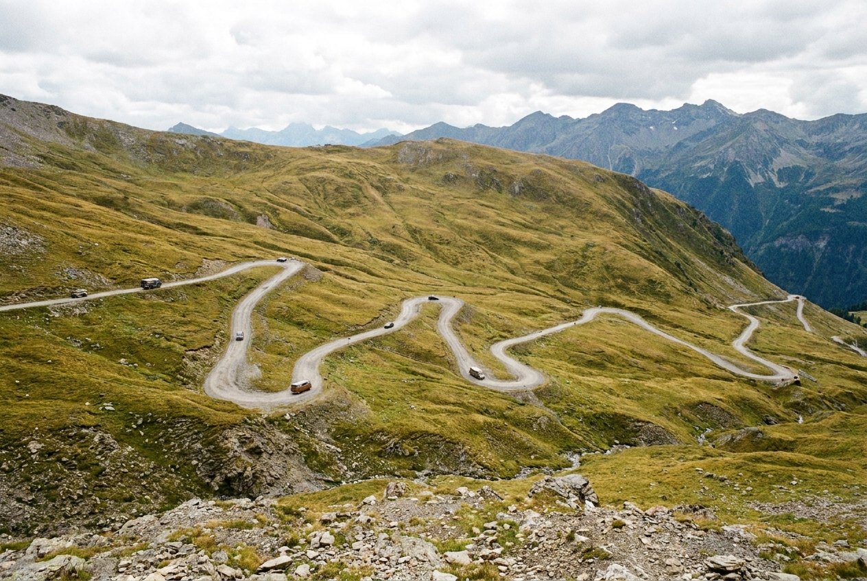
A road built over the top
The Transfăgărășan, road DN7C, crosses the Făgăraș Mountains, the highest range in Romania's Carpathians, joining Transylvania in the north to the Argeș valley in the south. It was built between 1970 and 1974, much of it by the army, and it climbs to just over 2,000 m near Bâlea Lake, where a tunnel takes it through the main ridge. The mountain section, the part worth the drive, is about 90 km from the Olt valley in the north to the Vidraru dam in the south.
From above, the northern side looks like a ribbon dropped on a slope: one hairpin stacked on top of the next, climbing out of beech forest and up across bare grass and rock. Driving it is slower than it looks. Allow most of a day for the crossing with stops, or split it over two and stay a night at either end.
The northern climb to Bâlea Lake
Coming from the north, you leave the main road along the Olt valley, between Sibiu and Făgăraș town, and head straight at the wall of mountains. The road runs up through forest to Bâlea Cascadă, where a waterfall drops down the valley side and a cable car goes up towards the lake. Above that the trees end and the hairpins begin.
This is the section people come for. Take it in a low gear on the way down and keep your speed modest on the way up; many of the bends are tight enough that a long vehicle needs the whole road. Watch for cars stopped on the outside of bends, for cyclists grinding up in the middle of your lane, and for motorbikes passing where they should not. The view back down the valley is best from the pull-outs, not from the driver's seat.
Bâlea Lake is a glacial lake in a bowl just below the tunnel, cold and clear, with paths up onto the ridges around it. It is busy at weekends in summer, and the car parks fill up by late morning.
Through the ridge and down the south side
The tunnel under the ridge is close to 900 m long, narrow and often wet, with water dripping from the roof. Lights on, speed down. You come out into a different valley, longer and more wooded, and the descent on the southern side is gentler but goes on for longer, through forest and along the shore of Lake Vidraru to the dam wall at its southern end.
Detour · stop 06The North Coast 500, Scotland's far north in one loopJust below the dam, the ruins of Poenari Citadel sit on a crag high above the road. The fortress is linked with Vlad III, the prince later remembered as Vlad the Impaler. Reaching it means a long climb of well over a thousand steps through the forest. Access has sometimes been restricted when bears are active nearby, so check before you set out.
Bears by the road
Brown bears live in these mountains, and on the southern side especially you may see them at the roadside, sometimes close enough to touch from a car window. Do not feed them, do not get out of the car to photograph them, and do not open your window to throw anything. Feeding is against the rules, and it is the reason bears come to the road in the first place: a bear that has learned to expect food from cars becomes dangerous, and is likely to be killed. Keep moving slowly, give the animal room, and never leave food or rubbish outside if you stop to eat.
The opening season
The high part of the road, roughly between Bâlea Cascadă and the southern side below the ridge, is closed for much of the year because of snow and avalanche risk. It usually opens around the start of July and closes by the end of October, but heavy snow can keep it shut later into summer or close it earlier in autumn, and storms can close it for a day at any time. Check the current status with the Romanian road authorities before you go. The lower sections at either end stay open longer, so you can still reach the waterfall from the north or the dam from the south outside the season.
Weather near the top changes fast. A warm morning in the valley can turn to cloud, rain and a few degrees above freezing at the lake by afternoon, and fog on the hairpins cuts visibility to almost nothing. Bring layers even in August. If you are weighing up when to go across all the high roads on this page, the notes on the shoulder months compare their seasons.
Driving it well
Go early. By ten on a summer weekend the northern hairpins are busy with cars, motorbikes and coaches, and the best light is gone. A weekday in early September often gives clear air and fewer people. Fill the tank in the valley before you start: there is no reason to run low on a road like this. Check your brakes feel right before the descent, and if they start to smell or soften, pull in and let them cool.
Romania has another high road a little to the west, the Transalpina, which climbs even higher over the Parâng Mountains and makes a good second day. Further afield, if you like a road that climbs to a pass and then drops into a different world, the Milford Road in New Zealand does something similar through a tunnel of its own. And for a sea-level contrast, the Atlantic Road in Norway packs its drama into eight flat kilometres.
The photographs on this stop are credited, with their licences, on who took the road photos.