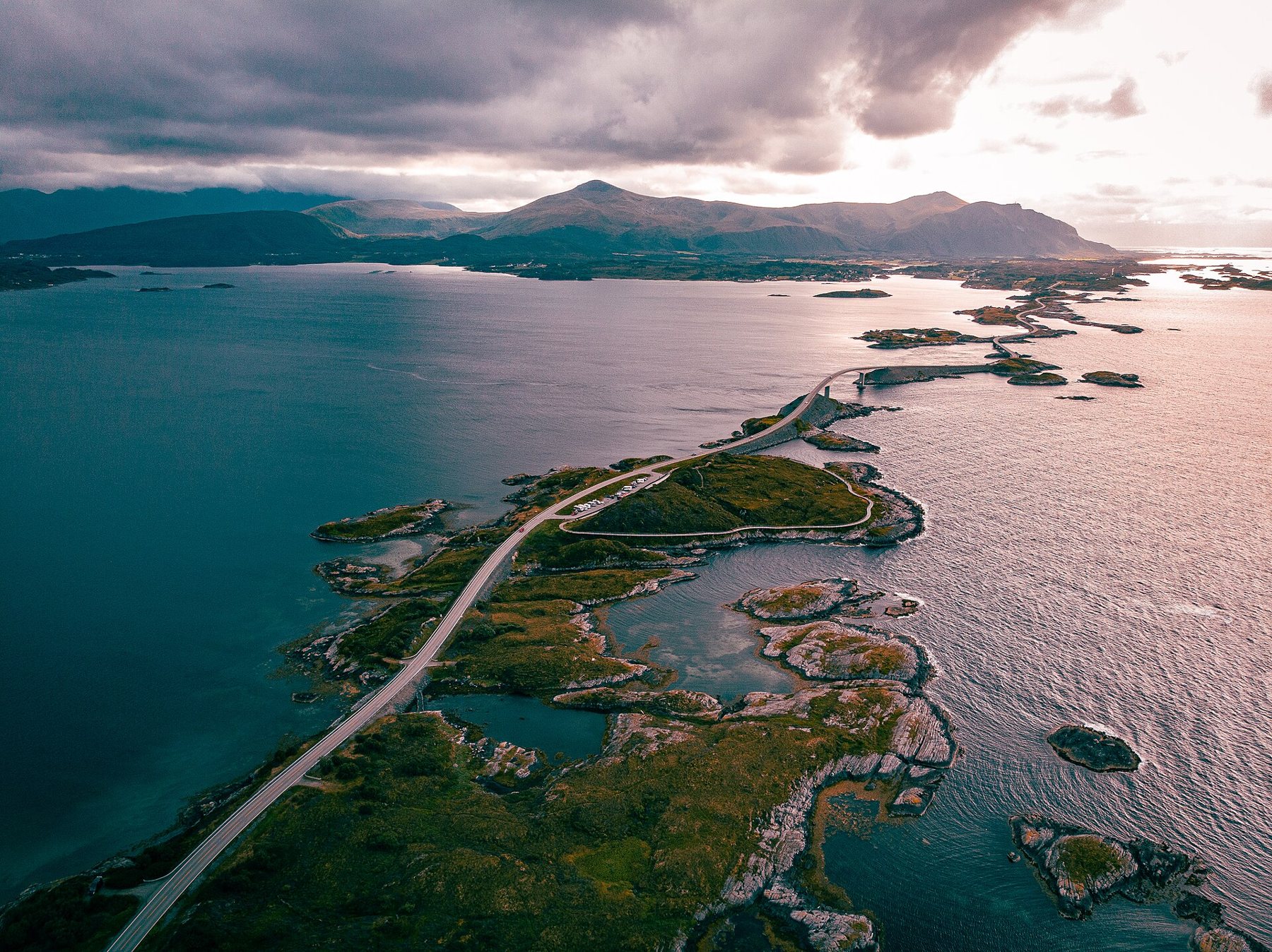
Eight kilometres and eight bridges
The Atlantic Road, Atlanterhavsveien in Norwegian, is a stretch of county road Fv64 about 8 km long on the coast of Møre og Romsdal. It runs across a scatter of small islands and skerries between the island of Averøy and the mainland, tying them together with low causeways and eight bridges. It opened in 1989 and is now one of Norway's National Tourist Routes, with rest areas and viewpoints built along it.
On a map it barely registers. Behind the wheel it feels very different, because for most of its length there is nothing between you and the open sea but a guard rail and a few metres of rock. On a calm summer evening the water is glass and the islets glow green. In an autumn gale the waves break over the causeways and spray drifts across the windscreen.
The bridge that seems to end in the air
Storseisundet Bridge is the longest of the eight and the one everyone comes for. It rises steeply and curves as it climbs, so that from some angles on the approach the road looks as if it lifts off and stops in mid-air. It is a trick of the curve. The deck is perfectly ordinary once you are on it, and the view from the top is over the whole chain of islands towards the mountains inland.
Do not stop on the bridge for photographs. There is no shoulder, the climb hides oncoming traffic, and the drivers behind you are looking at the view too. The rest areas at either end are the places to pull in, get out and walk back for the angle you want.
Where it fits on a longer drive
The road sits between two towns. Kristiansund lies to the north-east, linked to Averøy by a long tunnel under the sea; the descent and climb are steep, so keep an eye on your speed and stay in gear. Molde, the larger town, lies to the south, under an hour away along the mainland coast. Either makes a good base, and the Atlantic Road fits easily into half a day, with time to stop at every viewpoint.
Norwegian roads, bridges and tunnels often carry tolls that are collected automatically from the number plate, with no booth to stop at. Ask your hire company how those charges reach you before you set off. South of Molde, car ferries carry the main roads across the wider fjords; they run to timetables that change with the season, so check them before you plan a tight day.
Detour · stop 08The Transfăgărășan, hairpins over the CarpathiansStops between the islets
The road is short enough to drive twice, once each way, and the light changes enough between the two that it is worth doing. Eldhusøya, one of the islets near the middle, has a car park and a walkway that loops round the island's edge, with views back along the road to Storseisundet. Further along, Askevågen has a viewing platform out over the rocks with the sea on three sides.
Anglers fish from the rocks and from walkways on some of the bridges, and on a still day you will see a line of rods along the rails. Sea fishing from the shore in Norway is generally open to visitors without a licence, but rules on fish sizes, and on how much fish you may take out of the country, do apply. Check them before you go.
On Averøy, Kvernes Stave Church stands on a slope above the fjord, a short detour off the main road. To the south, on the mainland side, the fishing village of Bud looks out over a notorious stretch of open sea, and the coast road between there and Molde is a fine, quiet drive in its own right.
When the sea comes over the road
The Atlantic Road was built across one of the most exposed stretches of the Norwegian coast, and that is part of its draw. Autumn and winter storms throw waves right over the low sections, and some people come specifically to see that. If you do, treat it seriously. Strong gusts on the bridges can push a car sideways, high-sided vans and motorhomes catch the wind worst, and the road can be closed at short notice. Never stop on a causeway or bridge in a storm, keep both hands on the wheel, and drive through rather than stopping to watch.
Salt spray dries on the windscreen in a white film, so make sure the washer bottle is full before you leave town. In winter, the road can be icy where spray has frozen; your hire car should come with winter tyres in the cold months, but check.
Picking your light
This part of Norway lies south of the Arctic Circle, so you will not get the midnight sun, but summer evenings are long and the late light across the islands is soft and low. Mornings are quieter, before the coaches and motorhomes arrive. In July and August the rest areas fill up in the middle of the day; arrive early or late and you may have a viewpoint to yourself. Park only in marked spaces, and never in a passing place or on the verge of a causeway.
If you like this kind of coast road, where the weather is half the drive, the North Coast 500 in Scotland has the same mix of rock, sea and sudden squalls over a much longer loop. Iceland's Ring Road is the bigger relative across the water. And if you are deciding when to travel, the notes on the shoulder months set this road's calm summer against its stormy autumn.
The photographs on this stop are credited, with their licences, on who took the road photos.