The Carretera Austral, Chile's long road south
About 1,240 km of Ruta 7 from Puerto Montt to Villa O'Higgins, through Patagonian rainforest and lake country, with ferry crossings, long gravel stretches and little fuel.
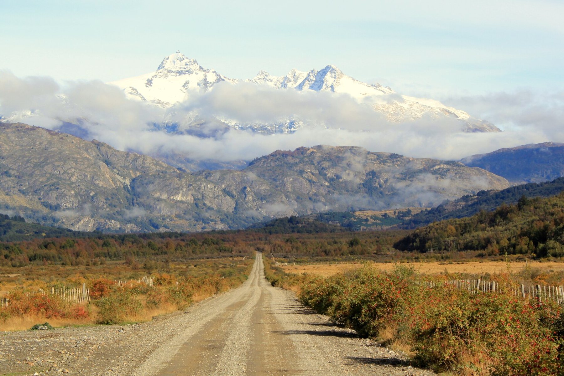
A road through the wilderness
The Carretera Austral, Chile's Ruta 7, runs about 1,240 km south from Puerto Montt to Villa O'Higgins, through the lakes, fjords and forests of northern Patagonia. Before it was built, much of this region could only be reached by sea or through Argentina. The road joins together small towns and farms strung along valleys under glaciers and snow peaks, and it still feels like a road through the wild.
It is not a single continuous road. Ferries carry you across several gaps where water or mountains break the route, and long sections are still gravel, though paving is advancing year by year. Two weeks is the least that works; three gives you time for walks, boat trips and bad weather. Driving on the right, with no hurry.
Ferries in the north
South of Puerto Montt, the first gap comes almost at once: a short ferry across an inlet, frequent and simple. Further on, at Hornopirén, the road stops and you take a longer ferry route south to Caleta Gonzalo, with a short drive between two crossings. These run more often in summer than the rest of the year, and in high season you should book ahead. An alternative is a longer ferry from Puerto Montt or the island of Chiloé direct to Chaitén. Timetables, routes and fares change, so check them before you go and leave slack in your plan.
From Caleta Gonzalo the road runs through Pumalín Park, a temperate rainforest of giant ferns and ancient trees, to Chaitén, a town rebuilt after a volcanic eruption in 2008. Short trails from the roadside lead into the forest and up towards the volcano, and the campsites along this stretch are some of the most beautiful on the whole route.
Rain is the other thing to plan for in the north. This end of the road is among the wettest country in South America, and a dry day is a gift rather than a promise. Gravel turns to mud, rivers rise, and small landslides can block the road for hours. Build spare days into the trip so that one closure does not cost you a ferry.
Gravel and the art of patience
Between the paved stretches, the road is gravel, called ripio. It can be smooth and fast, or rough with loose stones, washboard ripples and potholes. Keep your speed down, especially on bends and downhill; loose gravel behaves like ball bearings under tyres. When a truck or bus comes the other way, slow right down and move to the edge, because the stones they throw can crack a windscreen. Dust can blind you for seconds after a vehicle passes; wait for it to settle before overtaking.
Check your spare tyre before you leave, and know how to change it. Punctures are common, and help may be hours away. Many hire contracts have specific terms about gravel roads, and if you plan to cross into Argentina, you need a permit from the hire company arranged well in advance. The notes on gravel in a hire car cover what to check.
Detour · stop 07Ruta 40: Argentina's road along the AndesQueulat and the lake country
South of Chaitén, the road runs through La Junta and Puyuhuapi, a village on a fjord with hot springs nearby. Just beyond, Queulat National Park holds the Ventisquero Colgante, a hanging glacier clinging to a cliff above a lake, with a waterfall spilling from its foot. A trail leads to a viewpoint; allow a few hours for the walk.
The road climbs over a pass in the park on tight bends, then drops to the lake country around Coyhaique, the biggest town on the route and the place to stock up, change money and service the car. If anything has been rattling on the gravel, this is where to have it looked at; the next real workshop may be several days away. Coyhaique also has the nearest airport for the southern half of the road, which some drivers use to start or finish here.
General Carrera Lake and the Marble Caves
South of Coyhaique, the road passes the jagged towers of Cerro Castillo and reaches General Carrera Lake, a huge glacial lake shared with Argentina, its water a startling turquoise. At Puerto Río Tranquilo, boats run out to the Marble Caves, where the lake has carved caverns and pillars from a marble headland, the stone streaked blue and white with reflected light. The boats go only when the lake is calm; strong wind can stop them for days.
The road follows the lakeshore on gravel, with views across the water to the mountains. The wind here can be fierce, gusting hard enough to push a small car across the road, so hold the wheel firmly on exposed stretches and open doors carefully. Further south, Cochrane is a small town on a river, the last place of any size before the end. A spur road leads off to Caleta Tortel, a village built on boardwalks over the water.
Fuel, cash and the end of the road
Fuel stations on the Carretera Austral are few and far apart. Small towns may have a single pump, and they can run dry before the next delivery. Fill up at every chance, and carry a jerrycan if your hire company allows it; the notes on fuel and distance explain how to plan. Cash machines are just as scarce, and many places do not take cards. Carry enough Chilean pesos for fuel, food and ferries.
The last section, south of Cochrane, is the most remote, with a short free ferry across a fjord on a limited timetable. Villa O'Higgins is where the road ends; beyond it, travellers continue to Argentina only on foot, by bicycle and by boat. The best months are December to March, the southern summer, when ferries run most often and days are long. Even then, expect rain and wind. The notes on the shoulder months say more about timing.
The photographs on this stop are credited, with their licences, on who took the road photos.